


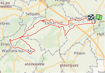
Rando 2 Vallées 2022( 23.2Kms Dén P 348m)

alain62rando
User

Length
23 km

Max alt
146 m

Uphill gradient
348 m
Km-Effort
28 km

Min alt
23 m

Downhill gradient
345 m
Boucle
Yes
Creation date :
2022-02-09 17:40:58.214
Updated on :
2022-02-14 15:59:56.989
4h20
Difficulty : Medium

FREE GPS app for hiking
 SityTrail
IGN / Geographical institutes
SityTrail Plus
The world is yours!
About
Trail Walking of 23 km to be discovered at Hauts-de-France, Pas-de-Calais, Wizernes. This trail is proposed by alain62rando.
Description
Ravitaillement N°1 8Kms
Ravitaillement N°2 14Kms
Ravitaillement N° 3 18,2Kms
Positioning
Country:
France
Region :
Hauts-de-France
Department/Province :
Pas-de-Calais
Municipality :
Wizernes
Location:
Unknown
Start:(Dec)
Start:(UTM)
445717 ; 5617262 (31U) N.
Comments