


Parkpad

SityTrail - itinéraires balisés pédestres
Tous les sentiers balisés d’Europe GUIDE+
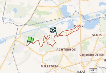

Length
10.7 km

Max alt
37 m

Uphill gradient
86 m
Km-Effort
11.9 km

Min alt
21 m

Downhill gradient
93 m
Boucle
No

Signpost
Creation date :
2022-02-09 19:00:20.001
Updated on :
2022-03-10 10:21:16.054
2h42
Difficulty : Easy

FREE GPS app for hiking
 SityTrail
IGN / Geographical institutes
SityTrail Plus
The world is yours!
About
Trail On foot of 10.7 km to be discovered at Flanders, Antwerp, Mol. This trail is proposed by SityTrail - itinéraires balisés pédestres.
Description
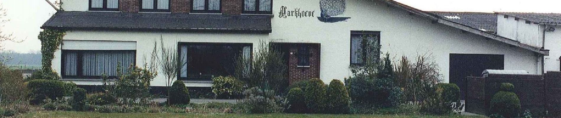
Trail created by tourisme mol.
Symbol: orange white arrow
Photos


Positioning
Country:
Belgium
Region :
Flanders
Department/Province :
Antwerp
Municipality :
Mol
Location:
Unknown
Start:(Dec)
Start:(UTM)
643360 ; 5674428 (31U) N.
Comments