


les Thuiles/les pras

andre06130
User
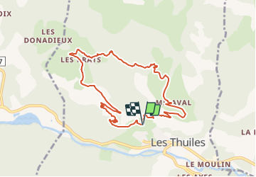

Length
9.6 km

Max alt
1670 m

Uphill gradient
500 m
Km-Effort
16.3 km

Min alt
1169 m

Downhill gradient
503 m
Boucle
Yes
Creation date :
2022-02-10 15:43:15.21
Updated on :
2022-02-11 13:53:35.218
3h42
Difficulty : Difficult

FREE GPS app for hiking
 SityTrail
IGN / Geographical institutes
SityTrail Plus
The world is yours!
About
Trail Walking of 9.6 km to be discovered at Provence-Alpes-Côte d'Azur, Alpes-de-Haute-Provence, Les Thuiles. This trail is proposed by andre06130.
Description
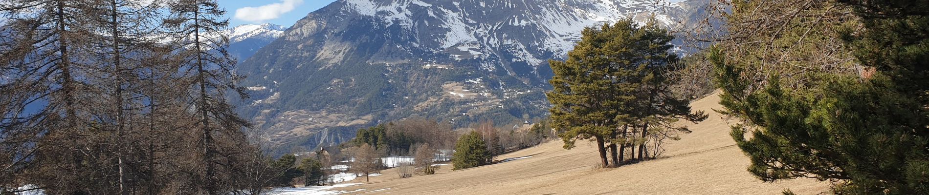
belles vues sur les Thuiles, le chapeau de gendarme et la tête de Louis XVI
Photos


Positioning
Country:
France
Region :
Provence-Alpes-Côte d'Azur
Department/Province :
Alpes-de-Haute-Provence
Municipality :
Les Thuiles
Location:
Unknown
Start:(Dec)
Start:(UTM)
306153 ; 4918799 (32T) N.
Comments