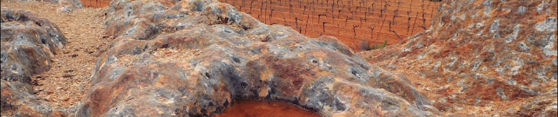
L'Etendoir des Fées à Aumes

ARVIEU
User
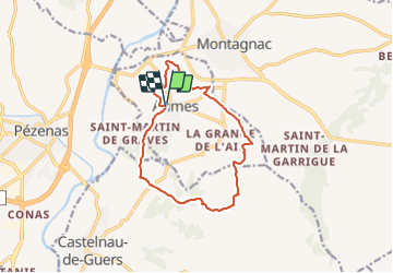

Length
13 km

Max alt
100 m

Uphill gradient
195 m
Km-Effort
15.6 km

Min alt
27 m

Downhill gradient
195 m
Boucle
Yes
Creation date :
2022-02-10 16:15:32.913
Updated on :
2022-02-10 16:19:22.899
4h00
Difficulty : Medium

FREE GPS app for hiking
 SityTrail
IGN / Geographical institutes
SityTrail Plus
The world is yours!
About
Trail Walking of 13 km to be discovered at Occitania, Hérault, Aumes. This trail is proposed by ARVIEU.
Photos


Positioning
Country:
France
Region :
Occitania
Department/Province :
Hérault
Municipality :
Aumes
Location:
Unknown
Start:(Dec)
Start:(UTM)
537400 ; 4812718 (31T) N.
Comments