


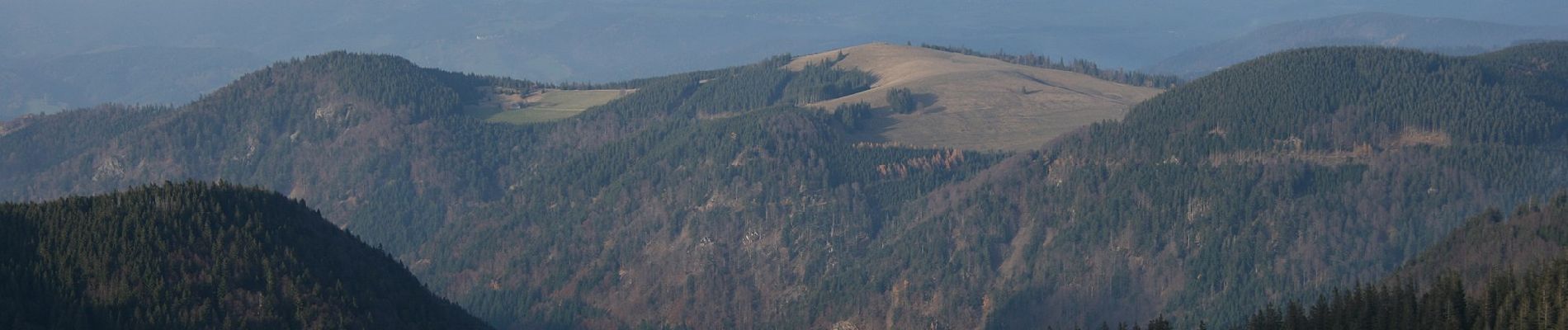
Feldbergsteig

SityTrail - itinéraires balisés pédestres
Tous les sentiers balisés d’Europe GUIDE+
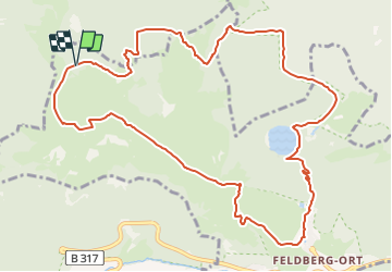

Length
12.3 km

Max alt
1488 m

Uphill gradient
533 m
Km-Effort
19.4 km

Min alt
1117 m

Downhill gradient
532 m
Boucle
Yes

Signpost
Creation date :
2022-02-11 12:51:29.9
Updated on :
2022-02-11 12:51:29.9
4h25
Difficulty : Easy

FREE GPS app for hiking
 SityTrail
IGN / Geographical institutes
SityTrail Plus
The world is yours!
About
Trail On foot of 12.3 km to be discovered at Baden-Württemberg, Landkreis Breisgau-Hochschwarzwald, Feldberg. This trail is proposed by SityTrail - itinéraires balisés pédestres.
Photos


Positioning
Country:
Germany
Region :
Baden-Württemberg
Department/Province :
Landkreis Breisgau-Hochschwarzwald
Municipality :
Feldberg
Location:
Feldberg (Ort)
Start:(Dec)
Start:(UTM)
425222 ; 5303267 (32T) N.
Comments