Trail On foot Hallstadt - Bamberger Rennsteig - Photo

Tous les sentiers balisés d’Europe GUIDE+

© OpenStreetMap contributors
Length
Length
22 km
Max alt
Max alt
347 m
Uphill gradient
Uphill gradient
269 m
Km-Effort
Km-Effort  
26 km
Min alt
Min alt
241 m
Downhill gradient
Downhill gradient
231 m
Boucle
Boucle
No
Signpost
Signpost
Creation date :
2022-02-11 12:52:05.784
Updated on :
2022-02-11 12:52:05.784

(0 Reviews)

On foot
On foot
5h53
Difficulty : Medium

Scan this QR Code to open this trail in the SityTrail application

FREE GPS app for hiking

Logo SityTrail SityTrail

IGN / Geographical institutes

Download SityTrail from the App Store Download SityTrail from Google Play

Logo SityTrail SityTrail World

The world is yours!

Download SityTrail from the App Store Download SityTrail from Google Play Download SityTrail on Huawei AppGallery

About

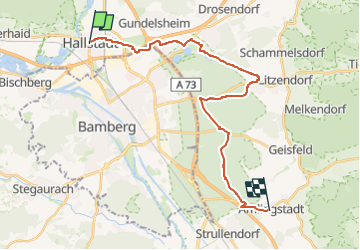
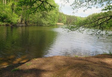
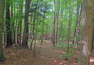
Trail On foot of 22 km to be discovered at Bavaria, Landkreis Bamberg, Hallstadt. This trail is proposed by SityTrail - itinéraires balisés pédestres.

Description

Trail created by Rennsteigverein 1896 e.V..

Symbol: Grünes R auf weißem Hintergrund

Elevation profile

Photos

Positioning

Country:
Germany
Region :
Bavaria
Department/Province :
Landkreis Bamberg
Municipality :
Hallstadt
Location:
Unknown
Start:(UTM)
634590 ; 5532418 (32U) N.

Trails nearby

Trail On foot Breitengüßbach - Breitengüßbacher Brauereienweg - Photo
On foot
GUIDE+

On foot

Easy
Breitengüßbach, Bavaria, Landkreis Bamberg, Germany
16.7 km | 19.2 km-effort
4h 21min
Yes
Trail On foot Breitengüßbach - Rundwanderweg Breitengüßbach 3 - Photo
On foot
GUIDE+

On foot

Easy
Breitengüßbach, Bavaria, Landkreis Bamberg, Germany
4.9 km | 5.8 km-effort
1h 19min
Yes
Trail On foot Breitengüßbach - Rundwanderweg Breitengüßbach 1 - Photo
On foot
GUIDE+

On foot

Easy
Breitengüßbach, Bavaria, Landkreis Bamberg, Germany
13.3 km | 15.9 km-effort
3h 36min
Yes
Trail On foot Breitengüßbach - Rundwanderweg Breitengüßbach 2 - Photo
On foot
GUIDE+

On foot

Easy
Breitengüßbach, Bavaria, Landkreis Bamberg, Germany
8.1 km | 9.9 km-effort
2h 15min
Yes
Trail On foot  - Alter Roßdorfer Stadtweg - Photo
On foot
GUIDE+

On foot

Easy
, Bavaria, Bamberg, Germany
6.9 km | 8.2 km-effort
1h 51min
No
Trail On foot  - Spaziergang durch die Gärtnerstadt - Photo
On foot
GUIDE+

On foot

Easy
, Bavaria, Bamberg, Germany
5.3 km | 5.7 km-effort
1h 18min
Yes
Trail On foot Oberhaid - Oberhaid Vogelherdrunde - Photo
On foot
GUIDE+

On foot

Easy
Oberhaid, Bavaria, Landkreis Bamberg, Germany
6.6 km | 8.2 km-effort
1h 51min
Yes
Trail On foot Oberhaid - Oberhaid Blockhütte - Photo
On foot
GUIDE+

On foot

Easy
Oberhaid, Bavaria, Landkreis Bamberg, Germany
10.2 km | 12.7 km-effort
2h 53min
Yes
Trail On foot Oberhaid - Oberhaid Mönchseerunde - Photo
On foot
GUIDE+

On foot

Easy
Oberhaid, Bavaria, Landkreis Bamberg, Germany
3.9 km | 4.5 km-effort
1h 1min
Yes


Close
My subscriptions