


D'Aspremont

GrouGary
User
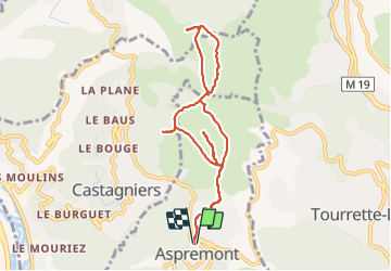

Length
9.8 km

Max alt
867 m

Uphill gradient
534 m
Km-Effort
16.9 km

Min alt
498 m

Downhill gradient
532 m
Boucle
Yes
Creation date :
2022-02-11 08:30:09.391
Updated on :
2022-02-18 17:59:42.787
3h40
Difficulty : Easy

FREE GPS app for hiking
 SityTrail
IGN / Geographical institutes
SityTrail Plus
The world is yours!
About
Trail Walking of 9.8 km to be discovered at Provence-Alpes-Côte d'Azur, Maritime Alps, Aspremont. This trail is proposed by GrouGary.
Description
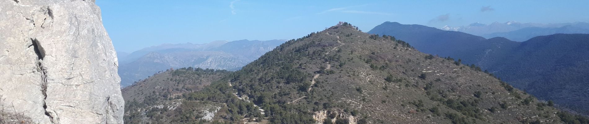
Succession de 4 petits sommets : Vieux Aspremont et ses ruines, la croix de cuore, le mont Cima et le Mont Inarte.
Photos

Positioning
Country:
France
Region :
Provence-Alpes-Côte d'Azur
Department/Province :
Maritime Alps
Municipality :
Aspremont
Location:
Unknown
Start:(Dec)
Start:(UTM)
358716 ; 4849437 (32T) N.
Comments