


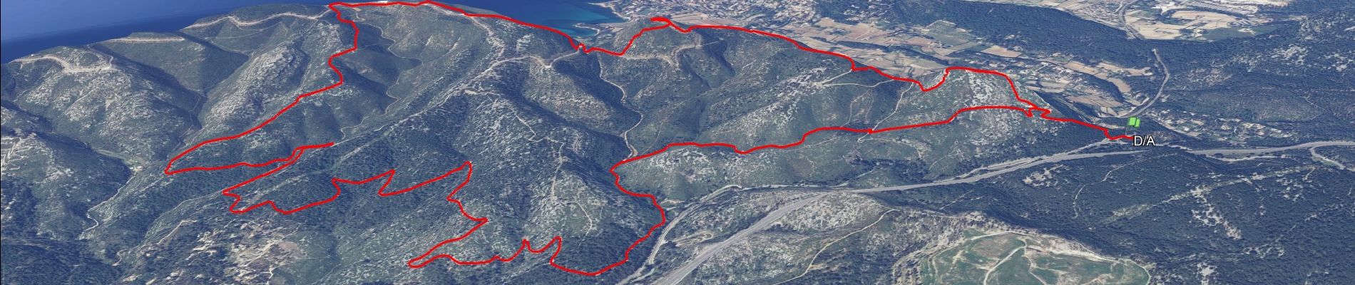
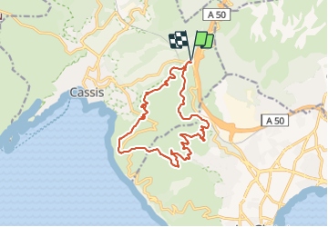
SityTrail - cassis la couronne

affinetataille
User GUIDE

Length
16.1 km

Max alt
333 m

Uphill gradient
556 m
Km-Effort
24 km

Min alt
118 m

Downhill gradient
556 m
Boucle
Yes
Creation date :
2022-02-11 15:53:34.772
Updated on :
2022-03-04 18:05:39.647
6h00
Difficulty : Medium

FREE GPS app for hiking
 SityTrail
IGN / Geographical institutes
SityTrail Plus
The world is yours!
About
Trail Walking of 16.1 km to be discovered at Provence-Alpes-Côte d'Azur, Bouches-du-Rhône, Cassis. This trail is proposed by affinetataille.
Photos


28 photos in total. Please click on a photo to see them all in the gallery.
Positioning
Country:
France
Region :
Provence-Alpes-Côte d'Azur
Department/Province :
Bouches-du-Rhône
Municipality :
Cassis
Location:
Unknown
Start:(Dec)
Start:(UTM)
709483 ; 4788789 (31T) N.
Comments
trop de pistes sur la fin. Mais belle rando surtout la 1ère partie