![](/images/other/stat-length.png)
![Trail On foot Ruppichteroth - Ruppichteroth Rundweg ⟂ Lot - Photo](https://media.geolcdn.com/t/1900/400/ext.pjpeg?maxdim=2&url=https%3A%2F%2Fmedia.geolcdn.com%2Ff%2F78d5a9ce-f446-46be-89c9-71f1f0260ab8.jpeg)
Ruppichteroth Rundweg ⟂ Lot
SityTrail - itinéraires balisés pédestres
Tous les sentiers balisés d’Europe PRO
![Length](/images/other/stat-length.png)
Length
9.4 km
![Max alt](https://static1.geolcdn.com/siteimages/upload/files/1508320355ic_sort_altitude_max_24dp.png)
Max alt
268 m
![Uphill gradient](https://static1.geolcdn.com/siteimages/upload/files/1508320355ic_sort_den_pos_24dp.png)
Uphill gradient
225 m
![Km-Effort](/images/other/stat-length.png)
Km-Effort
12.4 km
![Min alt](https://static1.geolcdn.com/siteimages/upload/files/1508320355ic_sort_altitude_min_24dp.png)
Min alt
152 m
![Downhill gradient](https://static1.geolcdn.com/siteimages/upload/files/1508320355ic_sort_den_neg_24dp.png)
Downhill gradient
226 m
![Boucle](https://static1.geolcdn.com/siteimages/upload/files/16400158638029165_repeat_loop_refresh_sync_direction_icon.png)
Boucle
Yes
Signpost
Creation date :
2022-02-11 17:18:37.432
Updated on :
2022-02-11 17:18:37.432
![On foot](https://static1.geolcdn.com/sitytour/trail-icons/100.png)
2h49
Difficulty : Easy
![Scan this QR Code to open this trail in the SityTrail application](https://capi.geolives.com/qq0zvz2zws4bq2lad0pu/sitytour/trails/3097680/qr.png?size=200)
FREE GPS app for hiking
About
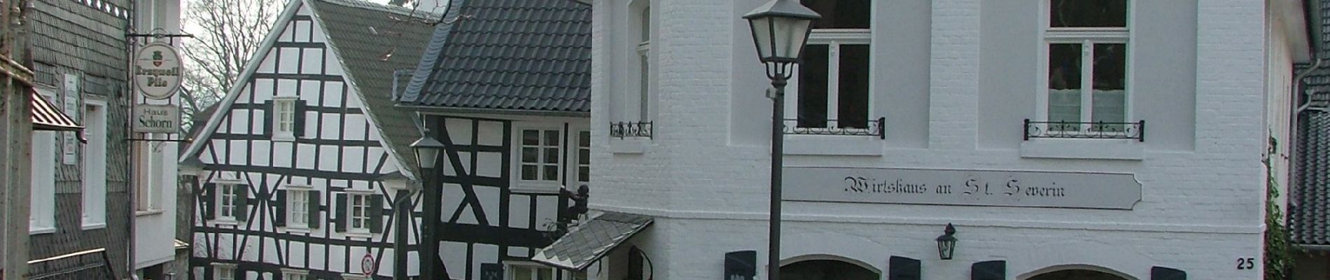
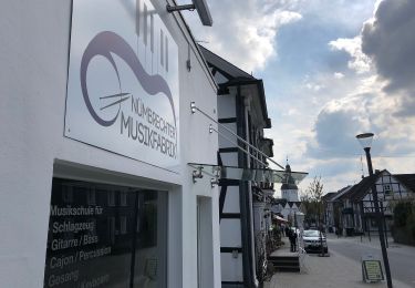
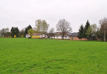
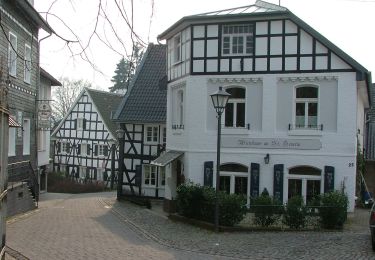
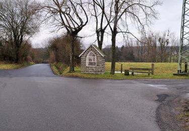
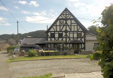
Trail On foot of 9.4 km to be discovered at North Rhine-Westphalia, Rhein-Sieg-Kreis, Ruppichteroth. This trail is proposed by SityTrail - itinéraires balisés pédestres.
Description
Trail created by Sauerländischer Gebirgsverein.
Symbol: white "⟂" (U 27C2, perpendicular, turned T) on black
Positioning
Country:
Germany
Region :
North Rhine-Westphalia
Department/Province :
Rhein-Sieg-Kreis
Municipality :
Ruppichteroth
Location:
Unknown
Start:(Dec)
Start:(UTM)
393176 ; 5633692 (32U) N.
Comments
Trails nearby
![Trail On foot Nümbrecht - Nümbrecht Kurpark Rundweg A1 - Photo](https://media.geolcdn.com/t/375/260/ext.jpg?maxdim=2&url=https%3A%2F%2Fmedia.geolcdn.com%2Ff%2F5f57f097-b7e5-4b91-8722-e83718571a74.jpeg)
![On foot On foot](https://static1.geolcdn.com/sitytour/trail-icons/100.png)
Nümbrecht Kurpark Rundweg A1
On foot
Easy
Nümbrecht,
North Rhine-Westphalia,
Oberbergischer Kreis,
Germany
![](/images/other/stat-length.png)
5 km | 6.1 km-effort
1h 23min
![](https://static1.geolcdn.com/siteimages/upload/files/16400158638029165_repeat_loop_refresh_sync_direction_icon.png)
No
![Trail On foot Ruppichteroth - Schönenberg Rundweg](https://media.geolcdn.com/t/375/260/ext.jpg?maxdim=2&url=https%3A%2F%2Fmedia.geolcdn.com%2Ff%2F90e3e7cd-b258-4fcf-b6cb-b94333a433e2.jpeg)
![On foot On foot](https://static1.geolcdn.com/sitytour/trail-icons/100.png)
Schönenberg Rundweg "■" (Quadrat)
On foot
Easy
Ruppichteroth,
North Rhine-Westphalia,
Rhein-Sieg-Kreis,
Germany
![](/images/other/stat-length.png)
5.2 km | 6.2 km-effort
1h 24min
![](https://static1.geolcdn.com/siteimages/upload/files/16400158638029165_repeat_loop_refresh_sync_direction_icon.png)
No
![Trail On foot Ruppichteroth - Ruppichteroth Rundweg](https://media.geolcdn.com/t/375/260/ext.jpg?maxdim=2&url=https%3A%2F%2Fmedia.geolcdn.com%2Ff%2F78d5a9ce-f446-46be-89c9-71f1f0260ab8.jpeg)
![On foot On foot](https://static1.geolcdn.com/sitytour/trail-icons/100.png)
Ruppichteroth Rundweg "●" (Vollkreis)
On foot
Easy
Ruppichteroth,
North Rhine-Westphalia,
Rhein-Sieg-Kreis,
Germany
![](/images/other/stat-length.png)
4.2 km | 5.4 km-effort
1h 13min
![](https://static1.geolcdn.com/siteimages/upload/files/16400158638029165_repeat_loop_refresh_sync_direction_icon.png)
No
![Trail On foot Ruppichteroth - Ruppichteroth Rundweg Rechteck - Photo](https://media.geolcdn.com/t/375/260/ext.jpg?maxdim=2&url=https%3A%2F%2Fmedia.geolcdn.com%2Ff%2Fab5091f1-ce6b-4002-8da3-d8a41ee01a1e.jpeg)
![On foot On foot](https://static1.geolcdn.com/sitytour/trail-icons/100.png)
Ruppichteroth Rundweg Rechteck
On foot
Easy
Ruppichteroth,
North Rhine-Westphalia,
Rhein-Sieg-Kreis,
Germany
![](/images/other/stat-length.png)
10.8 km | 13.7 km-effort
3h 6min
![](https://static1.geolcdn.com/siteimages/upload/files/16400158638029165_repeat_loop_refresh_sync_direction_icon.png)
Yes
![Trail On foot Ruppichteroth - Ruppichteroth Rundweg - Photo](https://media.geolcdn.com/t/375/260/ext.jpg?maxdim=2&url=https%3A%2F%2Fmedia.geolcdn.com%2Ff%2F78d5a9ce-f446-46be-89c9-71f1f0260ab8.jpeg)
![On foot On foot](https://static1.geolcdn.com/sitytour/trail-icons/100.png)
Ruppichteroth Rundweg
On foot
Easy
Ruppichteroth,
North Rhine-Westphalia,
Rhein-Sieg-Kreis,
Germany
![](/images/other/stat-length.png)
8.1 km | 10 km-effort
2h 16min
![](https://static1.geolcdn.com/siteimages/upload/files/16400158638029165_repeat_loop_refresh_sync_direction_icon.png)
Yes
![Trail On foot Ruppichteroth - Ruppichteroth Rundweg](https://media.geolcdn.com/t/375/260/ext.jpg?maxdim=2&url=https%3A%2F%2Fmedia.geolcdn.com%2Ff%2F8f19845e-bdd8-47dd-a12a-c54a406528b2.jpeg)
![On foot On foot](https://static1.geolcdn.com/sitytour/trail-icons/100.png)
Ruppichteroth Rundweg "V"
On foot
Easy
Ruppichteroth,
North Rhine-Westphalia,
Rhein-Sieg-Kreis,
Germany
![](/images/other/stat-length.png)
10.8 km | 13.7 km-effort
3h 7min
![](https://static1.geolcdn.com/siteimages/upload/files/16400158638029165_repeat_loop_refresh_sync_direction_icon.png)
Yes
![Trail On foot Ruppichteroth - Ruppichteroth Rundweg - Photo](https://media.geolcdn.com/t/375/260/ext.jpg?maxdim=2&url=https%3A%2F%2Fmedia.geolcdn.com%2Ff%2F203581a0-7bc3-4d68-a56d-959336201edc.jpeg)
![On foot On foot](https://static1.geolcdn.com/sitytour/trail-icons/100.png)
Ruppichteroth Rundweg
On foot
Easy
Ruppichteroth,
North Rhine-Westphalia,
Rhein-Sieg-Kreis,
Germany
![](/images/other/stat-length.png)
4.6 km | 5.8 km-effort
1h 19min
![](https://static1.geolcdn.com/siteimages/upload/files/16400158638029165_repeat_loop_refresh_sync_direction_icon.png)
Yes
![Trail On foot Ruppichteroth - Ruppichteroth Rundweg Hohlquadrat - Photo](https://media.geolcdn.com/t/375/260/ext.jpg?maxdim=2&url=https%3A%2F%2Fmedia.geolcdn.com%2Ff%2F78d5a9ce-f446-46be-89c9-71f1f0260ab8.jpeg)
![On foot On foot](https://static1.geolcdn.com/sitytour/trail-icons/100.png)
Ruppichteroth Rundweg Hohlquadrat
On foot
Easy
Ruppichteroth,
North Rhine-Westphalia,
Rhein-Sieg-Kreis,
Germany
![](/images/other/stat-length.png)
5.1 km | 6.7 km-effort
1h 31min
![](https://static1.geolcdn.com/siteimages/upload/files/16400158638029165_repeat_loop_refresh_sync_direction_icon.png)
Yes
![Trail On foot Waldbröl - Pulvermühlenweg (Erlebnisweg Sieg Nr. 13) - Photo](https://media.geolcdn.com/t/375/260/ext.jpg?maxdim=2&url=https%3A%2F%2Fmedia.geolcdn.com%2Ff%2Ff5168160-4518-4cfd-a985-7c523c8063d7.jpeg)
![On foot On foot](https://static1.geolcdn.com/sitytour/trail-icons/100.png)
Pulvermühlenweg (Erlebnisweg Sieg Nr. 13)
On foot
Easy
Waldbröl,
North Rhine-Westphalia,
Oberbergischer Kreis,
Germany
![](/images/other/stat-length.png)
4.7 km | 6 km-effort
1h 21min
![](https://static1.geolcdn.com/siteimages/upload/files/16400158638029165_repeat_loop_refresh_sync_direction_icon.png)
No