Trail Walking Ormont-Dessus - w10_24_diable - Photo

Optez pour le retour à la nature GUIDE+
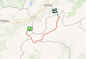
© OpenStreetMap contributors
Length
Length
12.9 km
Max alt
Max alt
2934 m
Uphill gradient
Uphill gradient
110 m
Km-Effort
Km-Effort  
17.3 km
Min alt
Min alt
2024 m
Downhill gradient
Downhill gradient
983 m
Boucle
Boucle
No
Creation date :
2014-12-10 00:00:00.0
Updated on :
2014-12-10 00:00:00.0

(0 Reviews)

Walking
Walking
3h38
Difficulty : Unknown

Scan this QR Code to open this trail in the SityTrail application

FREE GPS app for hiking

Logo SityTrail SityTrail

IGN / Geographical institutes

Download SityTrail from the App Store Download SityTrail from Google Play

Logo SityTrail SityTrail Plus

The world is yours!

Download SityTrail from the App Store Download SityTrail from Google Play Download SityTrail on Huawei AppGallery

About

Trail Walking of 12.9 km to be discovered at Vaud, District d'Aigle, Ormont-Dessus. This trail is proposed by My Switzerland.

Elevation profile

Points of interest

Point of interest Gsteig - Restaurant Berg-Camping “Heiti” - Photo
My Switzerland
Point of interest Savièse - Restaurant du Barrage du Sanetsch - Photo
My Switzerland
Point of interest Savièse - Refuge l'Espace - Photo
My Switzerland
SAVIÈSE 
Point of interest Savièse - Cabane du Prarochet - SAC - Photo
My Switzerland
Point of interest Ormont-Dessus - Restaurant Col du Pillon - Photo
My Switzerland
Point of interest Ormont-Dessus - Restaurant Botta - Photo
My Switzerland
ORMONT-DESSUS 
Point of interest Ormont-Dessus - Cabane des Diablerets - Photo
My Switzerland
ORMONT-DESSUS 

Positioning

Country:
Switzerland
Region :
Vaud
Department/Province :
District d'Aigle
Municipality :
Ormont-Dessus
Location:
Unknown
Start:(UTM)
361804 ; 5131923 (32T) N.


Close
My subscriptions