


Valbonnais Valsenestre 2 (Est)

Orcal37
User GUIDE
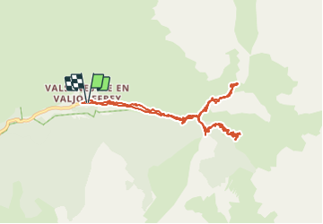

Length
11.7 km

Max alt
1800 m

Uphill gradient
663 m
Km-Effort
21 km

Min alt
1299 m

Downhill gradient
662 m
Boucle
Yes
Creation date :
2014-12-10 00:00:00.0
Updated on :
2021-09-22 18:34:53.108
4h00
Difficulty : Medium

FREE GPS app for hiking
 SityTrail
IGN / Geographical institutes
SityTrail Plus
The world is yours!
About
Trail Walking of 11.7 km to be discovered at Auvergne-Rhône-Alpes, Isère, Valjouffrey. This trail is proposed by Orcal37.
Description
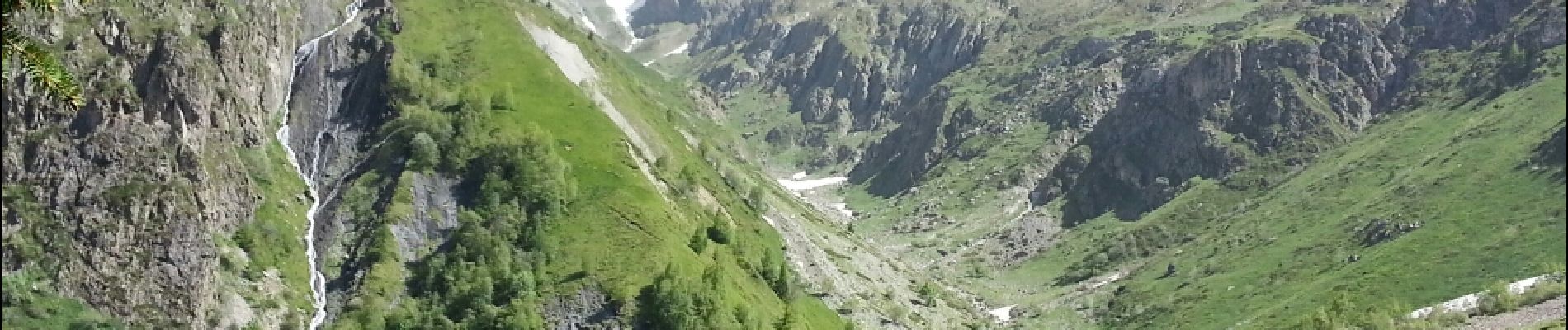
Valbonnais - Valsenestre Est - Orgues, Carrière
Photos
 - Photo 1")
 - Photo 2")
 - Photo 3")
 - Photo 4")
 - Photo 5")
Positioning
Country:
France
Region :
Auvergne-Rhône-Alpes
Department/Province :
Isère
Municipality :
Valjouffrey
Location:
Unknown
Start:(Dec)
Start:(UTM)
267511 ; 4976928 (32T) N.
Comments