


Tour au dessus des Dalis

andre06130
User
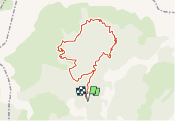

Length
10 km

Max alt
2134 m

Uphill gradient
523 m
Km-Effort
17 km

Min alt
1666 m

Downhill gradient
522 m
Boucle
Yes
Creation date :
2022-02-12 11:33:25.639
Updated on :
2022-02-12 11:37:04.737
3h54
Difficulty : Difficult

FREE GPS app for hiking
 SityTrail
IGN / Geographical institutes
SityTrail Plus
The world is yours!
About
Trail Walking of 10 km to be discovered at Provence-Alpes-Côte d'Azur, Alpes-de-Haute-Provence, Saint-Pons. This trail is proposed by andre06130.
Positioning
Country:
France
Region :
Provence-Alpes-Côte d'Azur
Department/Province :
Alpes-de-Haute-Provence
Municipality :
Saint-Pons
Location:
Unknown
Start:(Dec)
Start:(UTM)
310027 ; 4921018 (32T) N.
Comments