


gallician

BERNADETTE MONEY
User
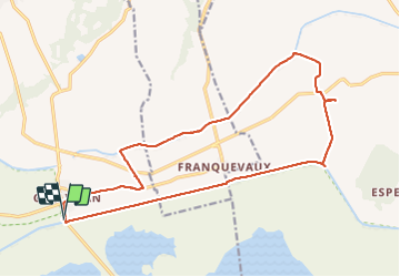

Length
20 km

Max alt
28 m

Uphill gradient
80 m
Km-Effort
21 km

Min alt
-3 m

Downhill gradient
80 m
Boucle
Yes
Creation date :
2022-02-12 08:42:49.453
Updated on :
2022-02-12 15:07:37.742
5h32
Difficulty : Very easy

FREE GPS app for hiking
 SityTrail
IGN / Geographical institutes
SityTrail Plus
The world is yours!
About
Trail Walking of 20 km to be discovered at Occitania, Gard, Vauvert. This trail is proposed by BERNADETTE MONEY.
Positioning
Country:
France
Region :
Occitania
Department/Province :
Gard
Municipality :
Vauvert
Location:
Unknown
Start:(Dec)
Start:(UTM)
604683 ; 4832531 (31T) N.
Comments