


Rothenburg Station - Neuenkirch

SityTrail - itinéraires balisés pédestres
Tous les sentiers balisés d’Europe GUIDE+
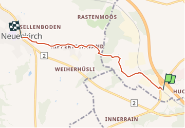

Length
4.6 km

Max alt
578 m

Uphill gradient
88 m
Km-Effort
5.6 km

Min alt
518 m

Downhill gradient
51 m
Boucle
No

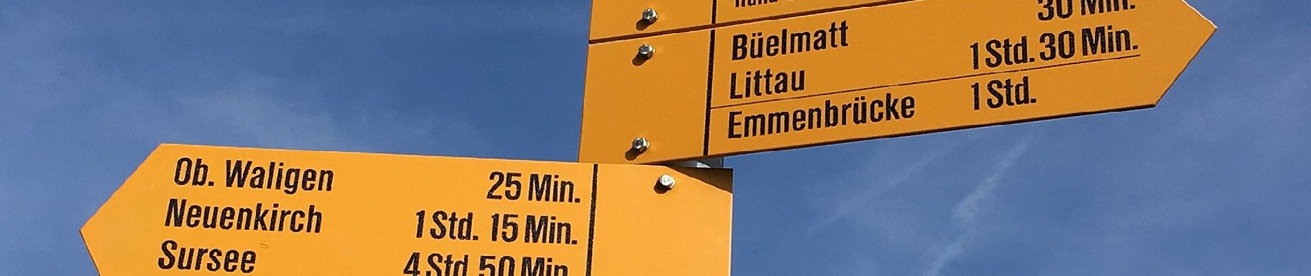
Signpost
Creation date :
2022-02-14 08:52:11.485
Updated on :
2022-02-14 08:52:11.485
1h16
Difficulty : Easy

FREE GPS app for hiking
 SityTrail
IGN / Geographical institutes
SityTrail Plus
The world is yours!
About
Trail On foot of 4.6 km to be discovered at Luzern, Unknown, Rothenburg. This trail is proposed by SityTrail - itinéraires balisés pédestres.
Description
Trail created by Luzerner Wanderwege.
Rothenburg Station - Neuenkirch
Symbol: gelber Diamant
Photos


Positioning
Country:
Switzerland
Region :
Luzern
Department/Province :
Unknown
Municipality :
Rothenburg
Location:
Unknown
Start:(Dec)
Start:(UTM)
443110 ; 5215187 (32T) N.
Comments