


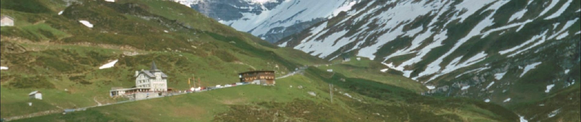
Höhenweg Schächental

SityTrail - itinéraires balisés pédestres
Tous les sentiers balisés d’Europe GUIDE+
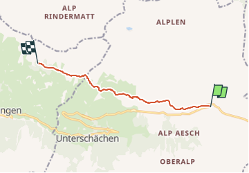

Length
7.8 km

Max alt
1870 m

Uphill gradient
276 m
Km-Effort
11.6 km

Min alt
1678 m

Downhill gradient
304 m
Boucle
No

Signpost
Creation date :
2022-02-14 08:55:08.963
Updated on :
2022-02-14 08:55:08.963
2h38
Difficulty : Easy

FREE GPS app for hiking
 SityTrail
IGN / Geographical institutes
SityTrail Plus
The world is yours!
About
Trail On foot of 7.8 km to be discovered at Uri, Unknown, Unterschächen. This trail is proposed by SityTrail - itinéraires balisés pédestres.
Description
Trail created by Wanderland Schweiz.
Symbol: Weisse 595 auf grünem Reckteck
Photos


Positioning
Country:
Switzerland
Region :
Uri
Department/Province :
Unknown
Municipality :
Unterschächen
Location:
Unknown
Start:(Dec)
Start:(UTM)
487166 ; 5191157 (32T) N.
Comments