


walser_22

My Switzerland
Optez pour le retour à la nature GUIDE+
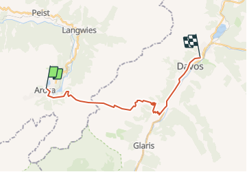

Length
19 km

Max alt
2438 m

Uphill gradient
961 m
Km-Effort
32 km

Min alt
1505 m

Downhill gradient
1134 m
Boucle
No
Creation date :
2014-12-10 00:00:00.0
Updated on :
2014-12-10 00:00:00.0
--
Difficulty : Unknown

FREE GPS app for hiking
 SityTrail
IGN / Geographical institutes
SityTrail Plus
The world is yours!
About
Trail Walking of 19 km to be discovered at Grisons, Plessur, Arosa. This trail is proposed by My Switzerland.
Positioning
Country:
Switzerland
Region :
Grisons
Department/Province :
Plessur
Municipality :
Arosa
Location:
Unknown
Start:(Dec)
Start:(UTM)
551854 ; 5180992 (32T) N.
Comments