


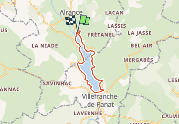
Circumlacustre Villefranche-de-Panat

SityTrail - itinéraires balisés pédestres
Tous les sentiers balisés d’Europe GUIDE+

Length
10.2 km

Max alt
747 m

Uphill gradient
108 m
Km-Effort
11.7 km

Min alt
725 m

Downhill gradient
108 m
Boucle
Yes

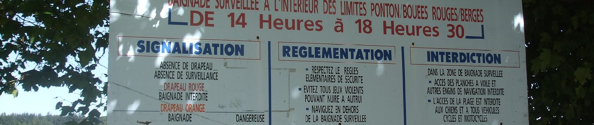
Signpost
Creation date :
2022-02-15 06:11:54.71
Updated on :
2022-03-02 14:47:59.698
2h39
Difficulty : Easy

FREE GPS app for hiking
 SityTrail
IGN / Geographical institutes
SityTrail Plus
The world is yours!
About
Trail On foot of 10.2 km to be discovered at Occitania, Aveyron, Alrance. This trail is proposed by SityTrail - itinéraires balisés pédestres.
Photos


Positioning
Country:
France
Region :
Occitania
Department/Province :
Aveyron
Municipality :
Alrance
Location:
Unknown
Start:(Dec)
Start:(UTM)
475068 ; 4885444 (31T) N.
Comments