


st_china_south

My Switzerland
Optez pour le retour à la nature GUIDE+
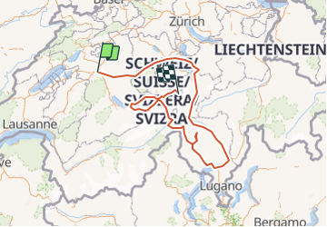

Length
433 km

Max alt
3125 m

Uphill gradient
36264 m
Km-Effort
910 km

Min alt
191 m

Downhill gradient
34341 m
Boucle
No
Creation date :
2014-12-10 00:00:00.0
Updated on :
2014-12-10 00:00:00.0
15h10
Difficulty : Unknown

FREE GPS app for hiking
 SityTrail
IGN / Geographical institutes
SityTrail Plus
The world is yours!
About
Trail Walking of 433 km to be discovered at Bern, Bern-Mittelland administrative district, Bern. This trail is proposed by My Switzerland.
Positioning
Country:
Switzerland
Region :
Bern
Department/Province :
Bern-Mittelland administrative district
Municipality :
Bern
Location:
Stadtteil IV
Start:(Dec)
Start:(UTM)
382789 ; 5201016 (32T) N.
Comments