Trail On foot Gif-sur-Yvette - PR4 - Photo

Tous les sentiers balisés d’Europe PRO

© OpenStreetMap contributors
Length
Length
3.6 km
Max alt
Max alt
161 m
Uphill gradient
Uphill gradient
70 m
Km-Effort
Km-Effort  
4.7 km
Min alt
Min alt
62 m
Downhill gradient
Downhill gradient
102 m
Boucle
Boucle
No
Signpost
Signpost
Creation date :
2022-02-15 14:23:29.875
Updated on :
2022-03-02 16:01:36.639

(0 Reviews)

On foot
On foot
1h03
Difficulty : Easy

Scan this QR Code to open this trail in the SityTrail application

FREE GPS app for hiking

Logo SityTrail SityTrail

IGN / Geographical institutes

Download SityTrail from the App Store Download SityTrail from Google Play

Logo SityTrail SityTrail World

The world is yours!

Download SityTrail from the App Store Download SityTrail from Google Play Download SityTrail on Huawei AppGallery

About

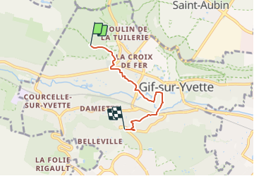
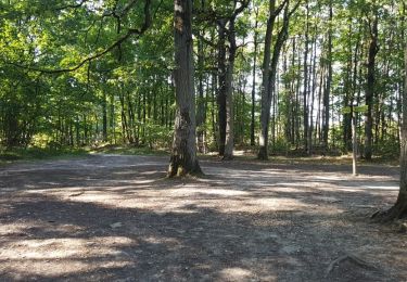
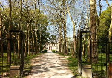
Trail On foot of 3.6 km to be discovered at Ile-de-France, Essonne, Gif-sur-Yvette. This trail is proposed by SityTrail - itinéraires balisés pédestres.

Description

Symbol: yellow bar

Photos

Positioning

Country:
France
Region :
Ile-de-France
Department/Province :
Essonne
Municipality :
Gif-sur-Yvette
Location:
Unknown
Start:(UTM)
434799 ; 5395436 (31U) N.

Trails nearby

Trail Walking Saint-Rémy-lès-Chevreuse - _Entre vallées et châteaux - Photo
Walking
GUIDE+

Walking

Medium
(13)
Saint-Rémy-lès-Chevreuse, Ile-de-France, Yvelines, France
7.8 km | 9.6 km-effort
2h 0min
Yes
Trail Walking Gif-sur-Yvette - _Gif sur Yvette, une ville à la campagne - Photo
Walking
GUIDE+

Walking

Medium
(3)
Gif-sur-Yvette, Ile-de-France, Essonne, France
8.6 km | 10.5 km-effort
2h 0min
Yes
Trail Walking Magny-les-Hameaux - _La Vallée de la Mérantaise - Photo
Walking
GUIDE+

Walking

Easy
(5)
Magny-les-Hameaux, Ile-de-France, Yvelines, France
9.7 km | 11.6 km-effort
2h 30min
Yes
Trail Walking Gometz-le-Châtel - Autour de Gometz le Châtel - Photo
Walking
tracegps

Walking

Medium
(1)
Gometz-le-Châtel, Ile-de-France, Essonne, France
7.8 km | 10.6 km-effort
2h 30min
Yes
Trail Walking Châteaufort - gitane à  Chateaufort  - Photo
Walking
philou91

Walking

Easy
(1)
Châteaufort, Ile-de-France, Yvelines, France
6.4 km | 7.7 km-effort
2h 3min
Yes
Trail Walking Bures-sur-Yvette - PR 9 Fauvettes - Photo
Walking
JacquesTB

Walking

Very easy
(1)
Bures-sur-Yvette, Ile-de-France, Essonne, France
6.6 km | 8.5 km-effort
2h 3min
Yes
Trail Walking Milon-la-Chapelle - Yvelines_Milon-La-Chapelle=>Chemins_Beauregard&Jean-Racine=>Chevreuse - Photo
Walking
BMorin91470

Walking

Easy
(1)
Milon-la-Chapelle, Ile-de-France, Yvelines, France
9.3 km | 12.7 km-effort
1h 56min
Yes
Trail Walking Orsay - Le long de l yvette - Photo
Walking
philou91

Walking

Very easy
(1)
Orsay, Ile-de-France, Essonne, France
8.5 km | 9.4 km-effort
2h 43min
Yes
Trail Mountain bike Saint-Rémy-lès-Chevreuse - Saint Rémy les Chevreuse - Virades de l'Espoir 25 km - Photo
Mountain bike
tracegps

Mountain bike

Medium
(1)
Saint-Rémy-lès-Chevreuse, Ile-de-France, Yvelines, France
23 km | 27 km-effort
2h 0min
No


Close
My subscriptions