


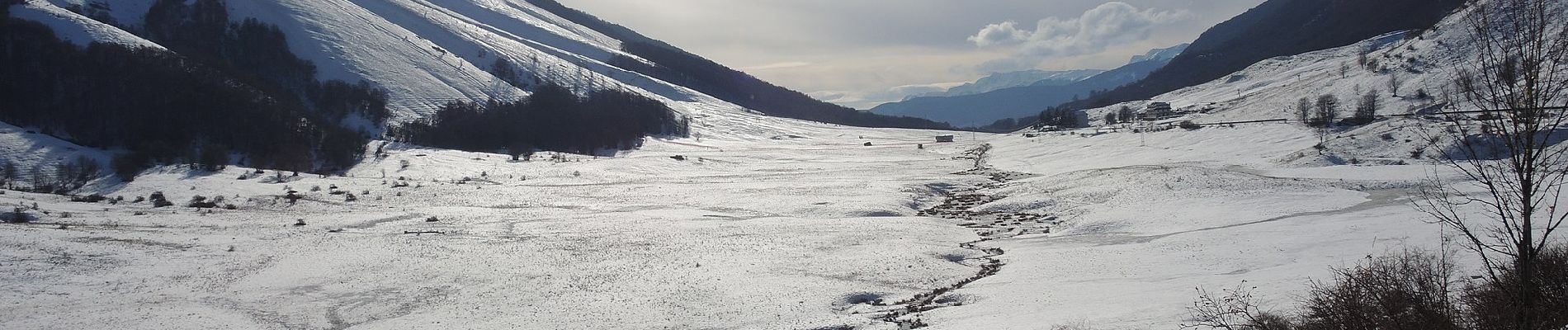
Scanno - Serra di Zio Mas

SityTrail - itinéraires balisés pédestres
Tous les sentiers balisés d’Europe GUIDE+
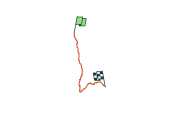

Length
11.7 km

Max alt
1636 m

Uphill gradient
639 m
Km-Effort
18.5 km

Min alt
1052 m

Downhill gradient
140 m
Boucle
No

Signpost
Creation date :
2022-02-15 17:09:52.782
Updated on :
2022-03-01 20:00:40.618
4h12
Difficulty : Easy

FREE GPS app for hiking
 SityTrail
IGN / Geographical institutes
SityTrail Plus
The world is yours!
About
Trail On foot of 11.7 km to be discovered at Abruzzo, L'Aquila, Scanno. This trail is proposed by SityTrail - itinéraires balisés pédestres.
Description
Symbol: Y7 on white red flags
Photos


Positioning
Country:
Italy
Region :
Abruzzo
Department/Province :
L'Aquila
Municipality :
Scanno
Location:
Unknown
Start:(Dec)
Start:(UTM)
407373 ; 4639397 (33T) N.
Comments