


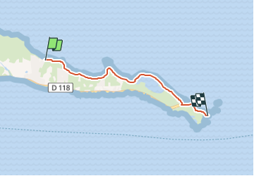
Sentier de la Pointe des Châteaux

SityTrail - itinéraires balisés pédestres
Tous les sentiers balisés d’Europe GUIDE+


1h26
Difficulty : Easy

FREE GPS app for hiking
 SityTrail
IGN / Geographical institutes
SityTrail Plus
The world is yours!
About
Trail On foot of 5.4 km to be discovered at Guadeloupe, Unknown, Saint-François. This trail is proposed by SityTrail - itinéraires balisés pédestres.
Description
Trail created by Parc National de la Guadeloupe.
Website: http://www.randoguadeloupe.gp/pedestre/sentier-de-la-pointe-des-chateaux/
Photos


Positioning
Comments