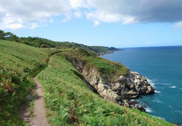
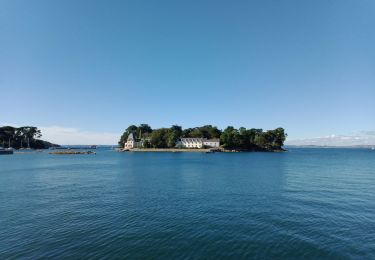
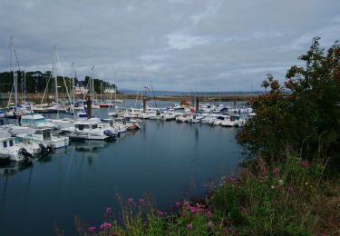
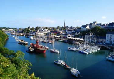
Trail On foot Douarnenez - Le chemin de la sardine - Photo

Le chemin de la sardine

Tous les sentiers balisés d’Europe PRO

© OpenStreetMap contributors
Length
Length
4.1 km
Max alt
Max alt
30 m
Uphill gradient
Uphill gradient
70 m
Km-Effort
Km-Effort  
5 km
Min alt
Min alt
0 m
Downhill gradient
Downhill gradient
63 m
Boucle
Boucle
No
Signpost
Signpost
Creation date :
2022-02-15 19:16:01.755
Updated on :
2022-03-02 23:33:00.059

(0 Reviews)

On foot
On foot
1h08
Difficulty : Easy

Scan this QR Code to open this trail in the SityTrail application

FREE GPS app for hiking

Logo SityTrail SityTrail

IGN / Geographical institutes

Download SityTrail from the App Store Download SityTrail from Google Play

Logo SityTrail SityTrail World

The world is yours!

Download SityTrail from the App Store Download SityTrail from Google Play Download SityTrail on Huawei AppGallery

About

Trail On foot of 4.1 km to be discovered at Brittany, Finistère, Douarnenez. This trail is proposed by SityTrail - itinéraires balisés pédestres.

Description

Ce circuit vous explique l'Histoire sardinière de la ville depuis l'époque Gallo-romaine jusqu'aux dernières mutations du port de Douarnenez. Des clous en bronze donnent la direction de 17 pupitres explicatifs illustrés par d'anciennes photos de la ville. Le circuit débute sur le belvédère des Plomarc'h, surplombant la baie et le port et propose une promenade dans la ville qui vous mènera du port du Rosmeur avec ses venelles et façades colorées, au Port Rhu, et au front de mer face à l'île Tristan. N'hésitez pas à venir chercher le feuillet du chemin de la sardine à l'Office de Tourisme. Durée : 2h00 Niveau de difficulté : facile. À certains passages, des escaliers. Retrouvez cet itinéraire dans le topo-guide L'Ouest Cornouaille ... à pied Le Pays de Douarnenez, le Cap Sizun et le Pays Bigouden. En vente en librairie, dans les offices de tourisme en Bretagne et sur https://bretagne.ffrandonnee.fr/topo/

Website: https://www.tourismebretagne.com/offres/le-chemin-de-la-sardine-douarnenez-fr-2395085/

Photos

Positioning

Country:
France
Region :
Brittany
Department/Province :
Finistère
Municipality :
Douarnenez
Location:
Unknown
Start:(UTM)
401468 ; 5327453 (30U) N.

Trails nearby

Trail Walking Douarnenez - Douarnenez - GR34 AR les Roches Blanches Pointe de la Jument  - 9.3km 250m 3h30 - 2019 09 01 - Photo
Walking
Orcal37

Walking

Medium
(1)
Douarnenez, Brittany, Finistère, France
9.3 km | 12.6 km-effort
3h 30min
Yes
Trail Walking Douarnenez - DOUARNENEZ  - Photo
Walking
RonanDAGORN

Walking

Very difficult
Douarnenez, Brittany, Finistère, France
22 km | 27 km-effort
5h 7min
Yes
Trail Walking Douarnenez - TREK RCY GR34 2022  j2 Douarnenez- Beuzec - Photo
Walking
chessyca

Walking

Medium
Douarnenez, Brittany, Finistère, France
23 km | 30 km-effort
6h 32min
No
Trail Walking Douarnenez - Trek RCY GR 34 2022- journée 1 Balade Douarnenez - Photo
Walking
chessyca

Walking

Very easy
Douarnenez, Brittany, Finistère, France
10.9 km | 13.3 km-effort
2h 33min
No
Trail Walking Plonévez-Porzay - DOUARNENEZ - Photo
Walking
RonanDAGORN

Walking

Medium
Plonévez-Porzay, Brittany, Finistère, France
26 km | 33 km-effort
6h 10min
Yes
Trail Walking Douarnenez - Douarnenez - GR34 du port de plaisance aux Roches Blanches - 9.7km 165m 2h30 - 2019 09 06 - Photo
Walking
Orcal37

Walking

Easy
Douarnenez, Brittany, Finistère, France
9.7 km | 11.9 km-effort
2h 30min
Yes
Trail Walking Douarnenez - Douarnenez - du Port Rhu - 5.8km 115m 1h45 - 2019 09 01 - Photo
Walking
Orcal37

Walking

Very easy
(1)
Douarnenez, Brittany, Finistère, France
5.8 km | 7.3 km-effort
1h 45min
Yes
Trail Walking Douarnenez - DOUARNENEZ - Bois du Nevet  - Photo
Walking
RonanDAGORN

Walking

Medium
Douarnenez, Brittany, Finistère, France
22 km | 27 km-effort
5h 36min
No
Trail Walking Le Juch - Le juch - Photo
Walking
fl29790

Walking

Medium
(1)
Le Juch, Brittany, Finistère, France
7.2 km | 8.7 km-effort
1h 55min
Yes


Close
My subscriptions