


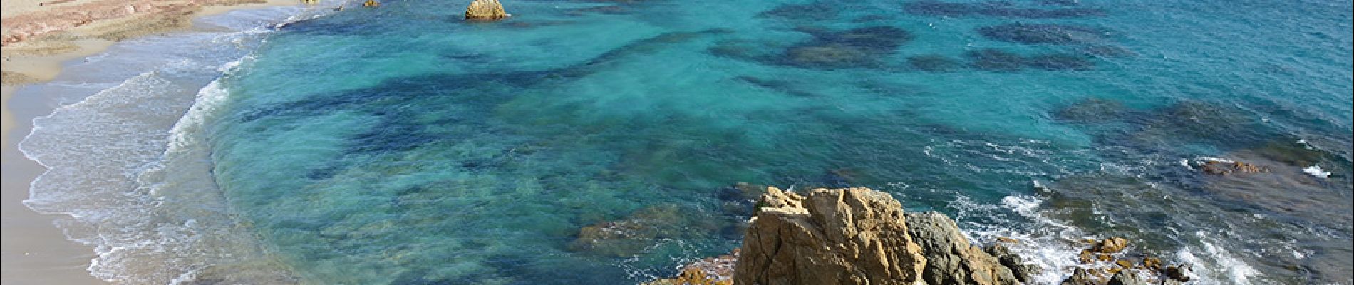
Bonne Terrasse - Cap Camarat - Plage de l'Escalet - Pointe de la Douane - Cap Lardier - Pointe de Brouis - Plage de Gigaro

LtZIP
User
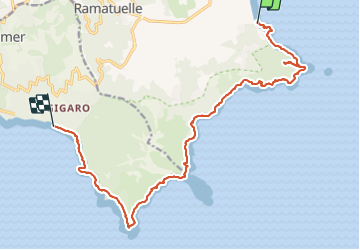

Length
18.1 km

Max alt
114 m

Uphill gradient
445 m
Km-Effort
24 km

Min alt
0 m

Downhill gradient
440 m
Boucle
No
Creation date :
2022-02-16 08:24:25.756
Updated on :
2022-02-17 09:49:42.843
5h22
Difficulty : Medium

FREE GPS app for hiking
 SityTrail
IGN / Geographical institutes
SityTrail Plus
The world is yours!
About
Trail Walking of 18.1 km to be discovered at Provence-Alpes-Côte d'Azur, Var, Ramatuelle. This trail is proposed by LtZIP.
Description
IBP
Orange 58
Photos


Positioning
Country:
France
Region :
Provence-Alpes-Côte d'Azur
Department/Province :
Var
Municipality :
Ramatuelle
Location:
Unknown
Start:(Dec)
Start:(UTM)
310245 ; 4786937 (32T) N.
Comments