


depart col de la charmette , la grande sure

gerardmicheline
User

Length
13.8 km

Max alt
1902 m

Uphill gradient
904 m
Km-Effort
26 km

Min alt
1294 m

Downhill gradient
897 m
Boucle
Yes
Creation date :
2022-02-17 13:59:33.435
Updated on :
2022-02-17 14:00:31.047
5h52
Difficulty : Very difficult

FREE GPS app for hiking
 SityTrail
IGN / Geographical institutes
SityTrail Plus
The world is yours!
About
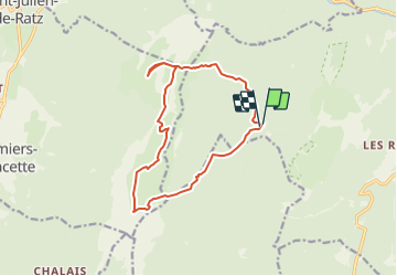
Trail Walking of 13.8 km to be discovered at Auvergne-Rhône-Alpes, Isère, Saint-Pierre-de-Chartreuse. This trail is proposed by gerardmicheline.
Positioning
Country:
France
Region :
Auvergne-Rhône-Alpes
Department/Province :
Isère
Municipality :
Saint-Pierre-de-Chartreuse
Location:
Unknown
Start:(Dec)
Start:(UTM)
714648 ; 5022677 (31T) N.
Comments