


les Alpilles d aureille

fernandezyvan
User
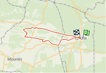

Length
14.8 km

Max alt
158 m

Uphill gradient
197 m
Km-Effort
17.4 km

Min alt
54 m

Downhill gradient
198 m
Boucle
Yes
Creation date :
2022-02-18 08:38:15.618
Updated on :
2022-02-18 14:33:31.445
4h38
Difficulty : Difficult

FREE GPS app for hiking
 SityTrail
IGN / Geographical institutes
SityTrail Plus
The world is yours!
About
Trail Walking of 14.8 km to be discovered at Provence-Alpes-Côte d'Azur, Bouches-du-Rhône, Aureille. This trail is proposed by fernandezyvan.
Photos


Positioning
Country:
France
Region :
Provence-Alpes-Côte d'Azur
Department/Province :
Bouches-du-Rhône
Municipality :
Aureille
Location:
Unknown
Start:(Dec)
Start:(UTM)
657170 ; 4841087 (31T) N.
Comments