


maisôñ

adubarry
User
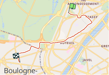

Length
5.8 km

Max alt
71 m

Uphill gradient
52 m
Km-Effort
6.6 km

Min alt
36 m

Downhill gradient
70 m
Boucle
No
Creation date :
2022-02-19 15:11:01.525
Updated on :
2022-02-19 16:44:14.957
1h32
Difficulty : Easy

FREE GPS app for hiking
 SityTrail
IGN / Geographical institutes
SityTrail Plus
The world is yours!
About
Trail Walking of 5.8 km to be discovered at Ile-de-France, Paris, Paris. This trail is proposed by adubarry.
Positioning
Country:
France
Region :
Ile-de-France
Department/Province :
Paris
Municipality :
Paris
Location:
16th Arrondissement
Start:(Dec)
Start:(UTM)
446267 ; 5412056 (31U) N.
Comments