


RANDO ESCLOPS SERVES SUR RHONE

TOULAUDIN
User
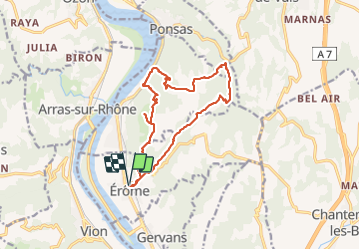

Length
14.6 km

Max alt
372 m

Uphill gradient
613 m
Km-Effort
23 km

Min alt
134 m

Downhill gradient
613 m
Boucle
Yes
Creation date :
2022-02-20 08:32:10.459
Updated on :
2022-02-21 16:29:44.364
5h29
Difficulty : Medium

FREE GPS app for hiking
 SityTrail
IGN / Geographical institutes
SityTrail Plus
The world is yours!
About
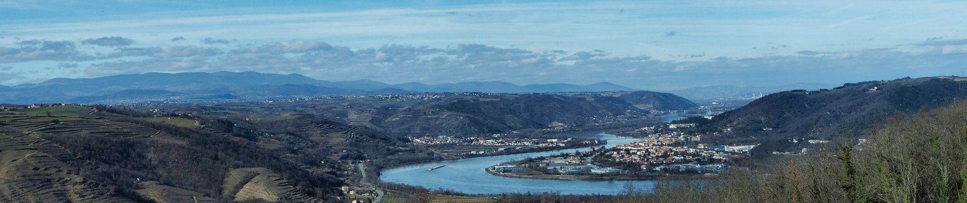
Trail Walking of 14.6 km to be discovered at Auvergne-Rhône-Alpes, Drôme, Érôme. This trail is proposed by TOULAUDIN.
Photos


Positioning
Country:
France
Region :
Auvergne-Rhône-Alpes
Department/Province :
Drôme
Municipality :
Érôme
Location:
Unknown
Start:(Dec)
Start:(UTM)
643265 ; 4997991 (31T) N.
Comments