


Route-AndorreLacDeRansol_openrunner

Nordic33
User GUIDE
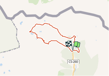

Length
6.8 km

Max alt
2526 m

Uphill gradient
562 m
Km-Effort
14.3 km

Min alt
1952 m

Downhill gradient
563 m
Boucle
Yes
Creation date :
2022-02-20 18:20:42.837
Updated on :
2022-02-20 18:22:00.051
3h15
Difficulty : Medium

FREE GPS app for hiking
 SityTrail
IGN / Geographical institutes
SityTrail Plus
The world is yours!
About
Trail Walking of 6.8 km to be discovered at Andorra. This trail is proposed by Nordic33.
Positioning
Country:
Andorra
Region :
Unknown
Department/Province :
Unknown
Municipality :
Unknown
Location:
Unknown
Start:(Dec)
Start:(UTM)
388269 ; 4718634 (31T) N.
Comments