


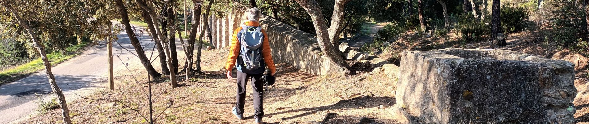
Rocher de Roquebrune sur Argens-23-02-22

Christiancordin
User
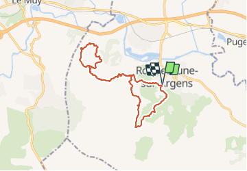

Length
16.9 km

Max alt
340 m

Uphill gradient
678 m
Km-Effort
26 km

Min alt
16 m

Downhill gradient
678 m
Boucle
Yes
Creation date :
2022-02-23 08:10:33.345
Updated on :
2022-02-27 17:55:00.379
7h04
Difficulty : Difficult

FREE GPS app for hiking
 SityTrail
IGN / Geographical institutes
SityTrail Plus
The world is yours!
About
Trail Walking of 16.9 km to be discovered at Provence-Alpes-Côte d'Azur, Var, Roquebrune-sur-Argens. This trail is proposed by Christiancordin.
Description
Roquebrune sur Argens-les 25 ponts-ravin de la Maurette-GR 51-les 3 croix-troglodytes-GR 51.
Photos


Positioning
Country:
France
Region :
Provence-Alpes-Côte d'Azur
Department/Province :
Var
Municipality :
Roquebrune-sur-Argens
Location:
Unknown
Start:(Dec)
Start:(UTM)
308566 ; 4812475 (32T) N.
Comments