


RS-Brion-LaBouchardiere

raymondfn
User
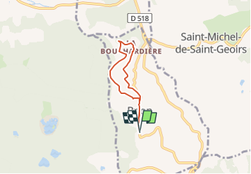

Length
4.7 km

Max alt
651 m

Uphill gradient
125 m
Km-Effort
6.3 km

Min alt
549 m

Downhill gradient
125 m
Boucle
Yes
Creation date :
2022-02-25 13:00:17.232
Updated on :
2024-11-27 09:29:31.211
1h26
Difficulty : Medium

FREE GPS app for hiking
 SityTrail
IGN / Geographical institutes
SityTrail Plus
The world is yours!
About
Trail Walking of 4.7 km to be discovered at Auvergne-Rhône-Alpes, Isère, Brion. This trail is proposed by raymondfn.
Positioning
Country:
France
Region :
Auvergne-Rhône-Alpes
Department/Province :
Isère
Municipality :
Brion
Location:
Unknown
Start:(Dec)
Start:(UTM)
683320 ; 5017756 (31T) N.
Comments