


La Mairola de Puget Rostand

GrouGary
User
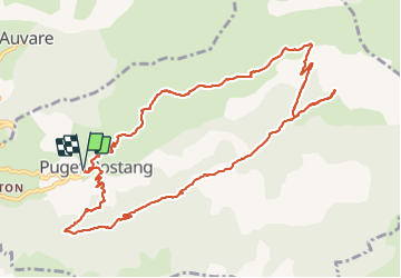

Length
13.4 km

Max alt
1583 m

Uphill gradient
878 m
Km-Effort
25 km

Min alt
700 m

Downhill gradient
879 m
Boucle
Yes
Creation date :
2022-02-25 08:49:47.553
Updated on :
2022-02-25 19:18:18.197
4h47
Difficulty : Medium

FREE GPS app for hiking
 SityTrail
IGN / Geographical institutes
SityTrail Plus
The world is yours!
About
Trail Walking of 13.4 km to be discovered at Provence-Alpes-Côte d'Azur, Maritime Alps, Puget-Rostang. This trail is proposed by GrouGary.
Description
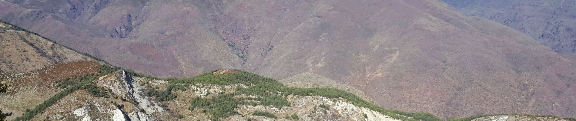
Belle boucle et pic nic sur promontoire, face a la tête de Rigaut et ĺe Mt Mounier.
880, 13 km
Photos


Positioning
Country:
France
Region :
Provence-Alpes-Côte d'Azur
Department/Province :
Maritime Alps
Municipality :
Puget-Rostang
Location:
Unknown
Start:(Dec)
Start:(UTM)
332953 ; 4871085 (32T) N.
Comments