


Lac juclar

ARPF
User
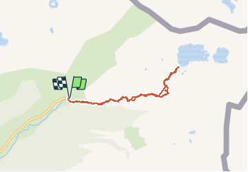

Length
8.3 km

Max alt
2301 m

Uphill gradient
465 m
Km-Effort
14.5 km

Min alt
1833 m

Downhill gradient
467 m
Boucle
Yes
Creation date :
2014-12-10 00:00:00.0
Updated on :
2014-12-10 00:00:00.0
3h05
Difficulty : Medium

FREE GPS app for hiking
 SityTrail
IGN / Geographical institutes
SityTrail Plus
The world is yours!
About
Trail Walking of 8.3 km to be discovered at Andorra. This trail is proposed by ARPF.
Description
23/06/14 Philippe P2 T2
Plein de fleurs dans le fond de la vallée.
Risques: Névés , 2 traversées à mi juin
Positioning
Country:
Andorra
Region :
Unknown
Department/Province :
Unknown
Municipality :
Unknown
Location:
Unknown
Start:(Dec)
Start:(UTM)
392370 ; 4717472 (31T) N.
Comments