Trail Walking Champey-sur-Moselle - CHAMPEY - LA FRONTIERE - Photo
© OpenStreetMap contributors
Length
Length
10.7 km
Max alt
Max alt
396 m
Uphill gradient
Uphill gradient
285 m
Km-Effort
Km-Effort  
14.5 km
Min alt
Min alt
171 m
Downhill gradient
Downhill gradient
286 m
Boucle
Boucle
Yes
Creation date :
2022-02-27 07:43:25.756
Updated on :
2022-02-27 11:14:52.766

(0 Reviews)

Walking
Walking
3h31
Difficulty : Easy

Scan this QR Code to open this trail in the SityTrail application

FREE GPS app for hiking

Logo SityTrail SityTrail

IGN / Geographical institutes

Download SityTrail from the App Store Download SityTrail from Google Play

Logo SityTrail SityTrail World

The world is yours!

Download SityTrail from the App Store Download SityTrail from Google Play Download SityTrail on Huawei AppGallery

About

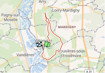
Trail Walking of 10.7 km to be discovered at Grand Est, Meurthe-et-Moselle, Champey-sur-Moselle. This trail is proposed by jean-marie.parachini.

Description

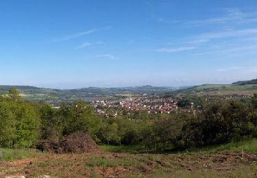
De Champey montée au plateau marquant la frontière avec la Moselle annexée de 1870 à 1918.
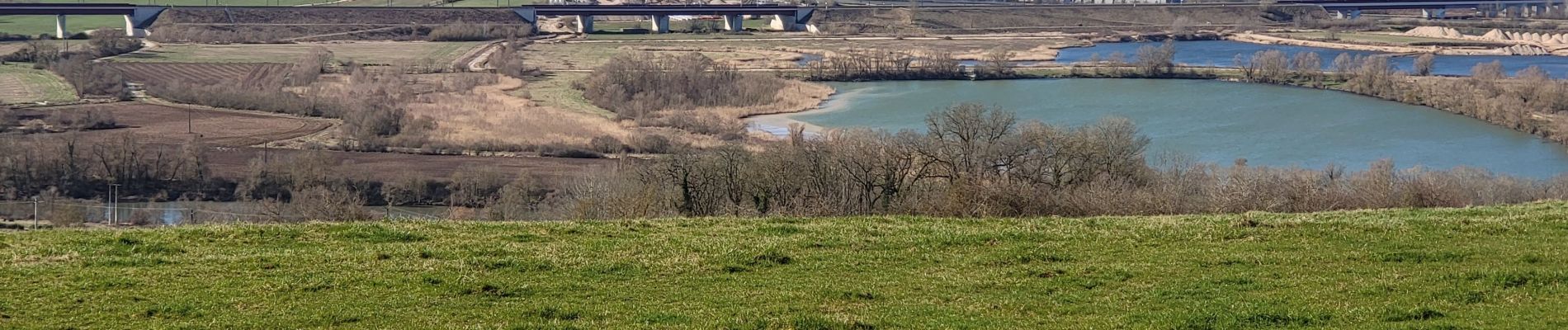
Points de vue à l'ouest sur la vallée de la Moselle et à l'est sur les villages de la vallée de la Seille au sud de Metz.

Elevation profile

Photos

Positioning

Country:
France
Region :
Grand Est
Department/Province :
Meurthe-et-Moselle
Municipality :
Champey-sur-Moselle
Location:
Unknown
Start:(UTM)
284665 ; 5426919 (32U) N.

Trails nearby

Trail On foot Arry - Circuit d'Arry Nord - Photo
On foot
PRO

On foot

Easy
Arry, Grand Est, Moselle, France
3.4 km | 4.2 km-effort
57min
No
Trail Mountain bike Pont-à-Mousson - Pose balises V3 - Photo
Mountain bike
PhilippeC54

Mountain bike

Medium
(1)
Pont-à-Mousson, Grand Est, Meurthe-et-Moselle, France
19.9 km | 26 km-effort
2h 1min
No
Trail Walking Pagny-sur-Moselle - Pagny sur Moselle - Photo
Walking
joelclaudel

Walking

Very easy
(1)
Pagny-sur-Moselle, Grand Est, Meurthe-et-Moselle, France
18.1 km | 23 km-effort
4h 55min
Yes
Trail Walking Arry - Arry - côte Saint Pierre - Vezon - Marieulles - Lorry Mardigny - Arry  - Photo
Walking
jean-marie.parachini

Walking

Medium
Arry, Grand Est, Moselle, France
13.9 km | 18 km-effort
24h 12min
Yes
Trail Walking Pagny-sur-Moselle - PAGNY SUR MOSELLE - VAL ET PLATEAU - Photo
Walking
jean-marie.parachini

Walking

Medium
Pagny-sur-Moselle, Grand Est, Meurthe-et-Moselle, France
18.1 km | 23 km-effort
6h 46min
Yes
Trail Walking Prény - Forêt de Preny dévastée quelle dommage - Photo
Walking
bitiba

Walking

Medium
Prény, Grand Est, Meurthe-et-Moselle, France
7.4 km | 9.7 km-effort
1h 14min
No
Trail Walking Prény - Marche Prény 2017 - Photo
Walking
pgydbt

Walking

Medium
(1)
Prény, Grand Est, Meurthe-et-Moselle, France
9.5 km | 13 km-effort
2h 41min
Yes
Trail Mountain bike Pagny-sur-Moselle - Vélo et Nature 2014 - Pagny sur Moselle - Photo
Mountain bike
tracegps

Mountain bike

Medium
Pagny-sur-Moselle, Grand Est, Meurthe-et-Moselle, France
34 km | 43 km-effort
2h 0min
Yes
Trail Walking Pagny-sur-Moselle - Pagny-sur-Moselle - Photo
Walking
edmondnagel

Walking

Easy
Pagny-sur-Moselle, Grand Est, Meurthe-et-Moselle, France
11 km | 11.7 km-effort
3h 0min
Yes


Close
My subscriptions