


Le chemin des antonins

pcugnod
User

Length
21 km

Max alt
652 m

Uphill gradient
585 m
Km-Effort
29 km

Min alt
350 m

Downhill gradient
584 m
Boucle
Yes
Creation date :
2022-02-27 09:07:43.0
Updated on :
2022-02-27 15:34:01.276
5h15
Difficulty : Difficult

FREE GPS app for hiking
 SityTrail
IGN / Geographical institutes
SityTrail Plus
The world is yours!
About
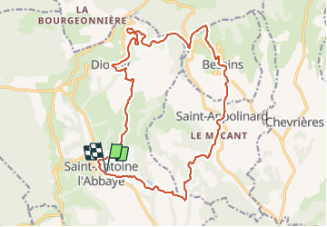
Trail Walking of 21 km to be discovered at Auvergne-Rhône-Alpes, Isère, Saint-Antoine l'Abbaye. This trail is proposed by pcugnod.
Positioning
Country:
France
Region :
Auvergne-Rhône-Alpes
Department/Province :
Isère
Municipality :
Saint-Antoine l'Abbaye
Location:
Saint-Antoine-l'Abbaye
Start:(Dec)
Start:(UTM)
674363 ; 5004726 (31T) N.
Comments