


Tessiner Gratwanderung: Monte Lema - Monte Tamaro

My Switzerland
Optez pour le retour à la nature GUIDE+

Length
17.6 km

Max alt
1931 m

Uphill gradient
1734 m
Km-Effort
38 km

Min alt
708 m

Downhill gradient
916 m
Boucle
No
Creation date :
2014-12-10 00:00:00.0
Updated on :
2014-12-10 00:00:00.0
--
Difficulty : Unknown

FREE GPS app for hiking
 SityTrail
IGN / Geographical institutes
SityTrail Plus
The world is yours!
About
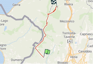
Trail Walking of 17.6 km to be discovered at Ticino, Distretto di Lugano, Miglieglia. This trail is proposed by My Switzerland.
Positioning
Country:
Switzerland
Region :
Ticino
Department/Province :
Distretto di Lugano
Municipality :
Miglieglia
Location:
Unknown
Start:(Dec)
Start:(UTM)
488893 ; 5096691 (32T) N.
Comments