


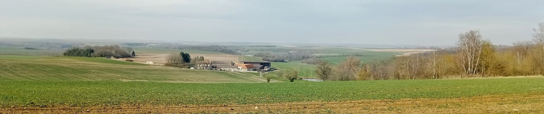
Mareuil-en-Dole du 01-03-2022

VANDERPUTTENMi
User GUIDE
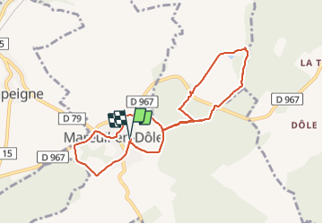

Length
8.2 km

Max alt
199 m

Uphill gradient
154 m
Km-Effort
10.3 km

Min alt
121 m

Downhill gradient
155 m
Boucle
Yes
Creation date :
2022-03-01 13:13:49.772
Updated on :
2022-03-01 20:11:48.944
2h05
Difficulty : Medium

FREE GPS app for hiking
 SityTrail
IGN / Geographical institutes
SityTrail Plus
The world is yours!
About
Trail Walking of 8.2 km to be discovered at Hauts-de-France, Aisne, Mareuil-en-Dôle. This trail is proposed by VANDERPUTTENMi.
Photos

Positioning
Country:
France
Region :
Hauts-de-France
Department/Province :
Aisne
Municipality :
Mareuil-en-Dôle
Location:
Unknown
Start:(Dec)
Start:(UTM)
540636 ; 5454449 (31U) N.
Comments