


Montrichard - GR41 Forêt GRP - 13.9km 220m 3h30 - 2022 03 03

Orcal37
User GUIDE
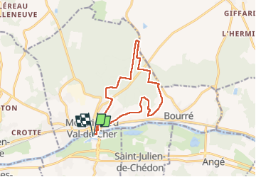

Length
13.9 km

Max alt
148 m

Uphill gradient
225 m
Km-Effort
16.9 km

Min alt
57 m

Downhill gradient
226 m
Boucle
Yes
Creation date :
2022-03-03 13:15:39.318
Updated on :
2022-09-13 17:28:35.085
3h30
Difficulty : Easy

FREE GPS app for hiking
 SityTrail
IGN / Geographical institutes
SityTrail Plus
The world is yours!
About
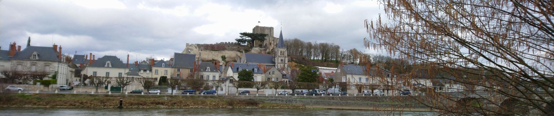
Trail Walking of 13.9 km to be discovered at Centre-Loire Valley, Loir-et-Cher, Faverolles-sur-Cher. This trail is proposed by Orcal37.
Description
Montrichard - GR41 Forêt GRP - 13.9km 220m 3h30 - 2022 03 03
Photos


Positioning
Country:
France
Region :
Centre-Loire Valley
Department/Province :
Loir-et-Cher
Municipality :
Faverolles-sur-Cher
Location:
Unknown
Start:(Dec)
Start:(UTM)
362894 ; 5244598 (31T) N.
Comments