


coupiac in live

CASSISFRAMBOISE
User
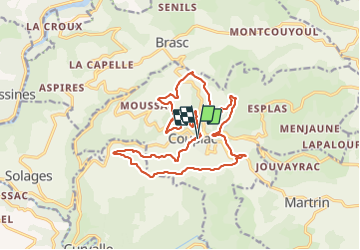

Length
18.9 km

Max alt
600 m

Uphill gradient
624 m
Km-Effort
27 km

Min alt
376 m

Downhill gradient
619 m
Boucle
Yes
Creation date :
2022-03-02 08:52:09.762
Updated on :
2022-03-04 07:41:59.608
4h31
Difficulty : Medium

FREE GPS app for hiking
 SityTrail
IGN / Geographical institutes
SityTrail Plus
The world is yours!
About
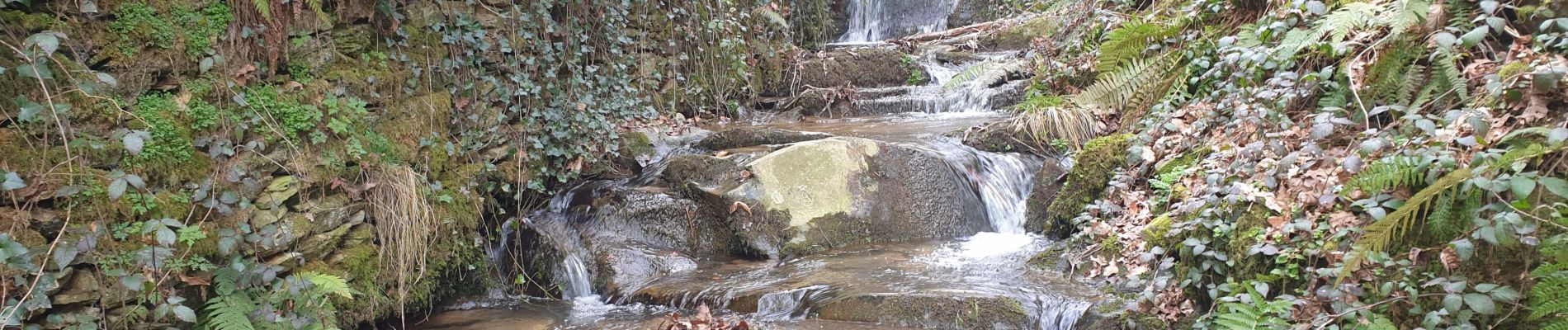
Trail Walking of 18.9 km to be discovered at Occitania, Aveyron, Coupiac. This trail is proposed by CASSISFRAMBOISE.
Photos


Positioning
Country:
France
Region :
Occitania
Department/Province :
Aveyron
Municipality :
Coupiac
Location:
Unknown
Start:(Dec)
Start:(UTM)
466437 ; 4866911 (31T) N.
Comments