


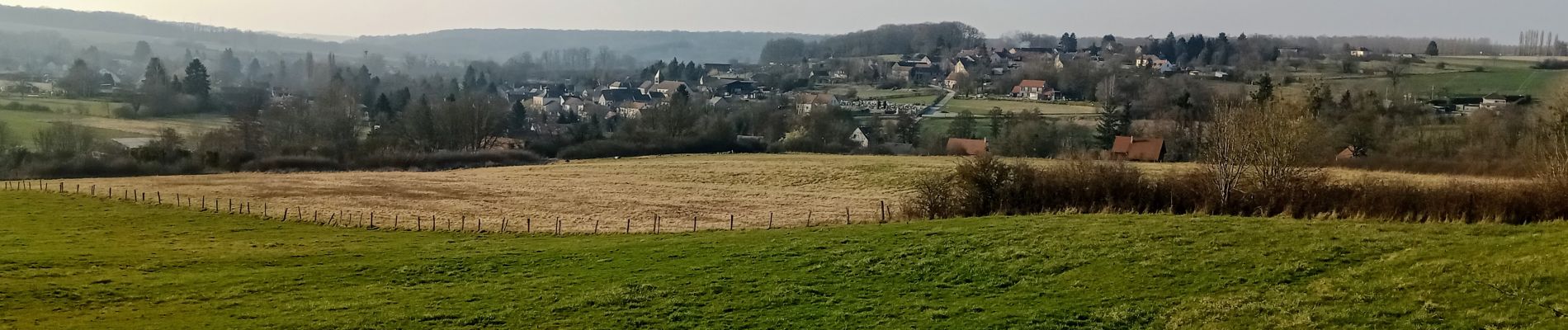
Beuvardes du 05/03/2022

VANDERPUTTENMi
User GUIDE
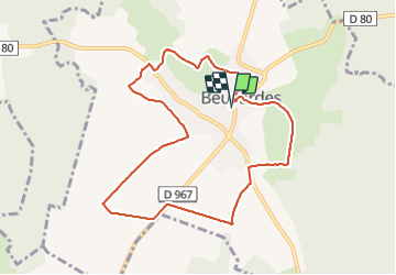

Length
8.7 km

Max alt
215 m

Uphill gradient
151 m
Km-Effort
10.8 km

Min alt
148 m

Downhill gradient
151 m
Boucle
Yes
Creation date :
2022-03-05 13:03:11.42
Updated on :
2022-03-05 17:22:44.208
1h57
Difficulty : Medium

FREE GPS app for hiking
 SityTrail
IGN / Geographical institutes
SityTrail Plus
The world is yours!
About
Trail Walking of 8.7 km to be discovered at Hauts-de-France, Aisne, Beuvardes. This trail is proposed by VANDERPUTTENMi.
Photos

Positioning
Country:
France
Region :
Hauts-de-France
Department/Province :
Aisne
Municipality :
Beuvardes
Location:
Unknown
Start:(Dec)
Start:(UTM)
535571 ; 5443024 (31U) N.
Comments