


Lac bleu

ARPF
User
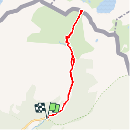

Length
11 km

Max alt
2396 m

Uphill gradient
638 m
Km-Effort
19.5 km

Min alt
1788 m

Downhill gradient
638 m
Boucle
Yes
Creation date :
2014-12-10 00:00:00.0
Updated on :
2014-12-10 00:00:00.0
4h01
Difficulty : Difficult

FREE GPS app for hiking
 SityTrail
IGN / Geographical institutes
SityTrail Plus
The world is yours!
About
Trail Walking of 11 km to be discovered at Andorra. This trail is proposed by ARPF.
Description
P2 T2 Jacques & Philippe 19/06/2014.
-Très belle vallée à ne pas rater.
-Pont après le refuge de Rialb impraticable.
Positioning
Country:
Andorra
Region :
Unknown
Department/Province :
Unknown
Municipality :
Unknown
Location:
Unknown
Start:(Dec)
Start:(UTM)
381264 ; 4720298 (31T) N.
Comments