


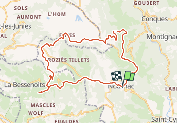
Compostelle boucle entre Conques et Decazeville

taguette
User

Length
22 km

Max alt
639 m

Uphill gradient
583 m
Km-Effort
30 km

Min alt
394 m

Downhill gradient
572 m
Boucle
Yes
Creation date :
2022-03-06 08:08:01.827
Updated on :
2022-03-06 13:21:14.476
5h09
Difficulty : Very difficult

FREE GPS app for hiking
 SityTrail
IGN / Geographical institutes
SityTrail Plus
The world is yours!
About
Trail Walking of 22 km to be discovered at Occitania, Aveyron, Conques-en-Rouergue. This trail is proposed by taguette.
Positioning
Country:
France
Region :
Occitania
Department/Province :
Aveyron
Municipality :
Conques-en-Rouergue
Location:
Unknown
Start:(Dec)
Start:(UTM)
450441 ; 4934857 (31T) N.
Comments