


Baume Oulins

pierre.chau
User

Length
16.3 km

Max alt
404 m

Uphill gradient
729 m
Km-Effort
26 km

Min alt
56 m

Downhill gradient
728 m
Boucle
Yes
Creation date :
2022-03-06 08:59:43.0
Updated on :
2022-03-06 16:23:57.705
6h20
Difficulty : Medium

FREE GPS app for hiking
 SityTrail
IGN / Geographical institutes
SityTrail Plus
The world is yours!
About
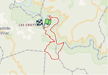
Trail Walking of 16.3 km to be discovered at Auvergne-Rhône-Alpes, Ardèche, Labastide-de-Virac. This trail is proposed by pierre.chau.
Positioning
Country:
France
Region :
Auvergne-Rhône-Alpes
Department/Province :
Ardèche
Municipality :
Labastide-de-Virac
Location:
Unknown
Start:(Dec)
Start:(UTM)
615582 ; 4912098 (31T) N.
Comments