


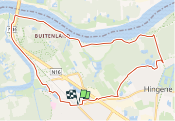
Bornem - Temse - Hingene - Bornem

Geert H.
User

Length
10.8 km

Max alt
9 m

Uphill gradient
51 m
Km-Effort
11.5 km

Min alt
-4 m

Downhill gradient
51 m
Boucle
Yes
Creation date :
2022-03-06 17:29:46.507
Updated on :
2022-03-06 17:29:46.507
2h36
Difficulty : Medium

FREE GPS app for hiking
 SityTrail
IGN / Geographical institutes
SityTrail Plus
The world is yours!
About
Trail Walking of 10.8 km to be discovered at Flanders, Antwerp, Bornem. This trail is proposed by Geert H..
Positioning
Country:
Belgium
Region :
Flanders
Department/Province :
Antwerp
Municipality :
Bornem
Location:
Bornem
Start:(Dec)
Start:(UTM)
586875 ; 5661653 (31U) N.
Comments