Trail Walking Vidauban - Vidauban - Cascade de l'Aille - Photo

Vidauban - Cascade de l'Aille

 soca
soca

User

© OpenStreetMap contributors
Length
Length
13.9 km
Max alt
Max alt
109 m
Uphill gradient
Uphill gradient
137 m
Km-Effort
Km-Effort  
15.7 km
Min alt
Min alt
36 m
Downhill gradient
Downhill gradient
133 m
Boucle
Boucle
Yes
Creation date :
2022-03-07 13:43:43.006
Updated on :
2022-03-07 13:52:07.529

(1 Reviews)

Walking
Walking
4h00
Difficulty : Easy

Scan this QR Code to open this trail in the SityTrail application

FREE GPS app for hiking

Logo SityTrail SityTrail

IGN / Geographical institutes

Download SityTrail from the App Store Download SityTrail from Google Play

Logo SityTrail SityTrail Plus

The world is yours!

Download SityTrail from the App Store Download SityTrail from Google Play Download SityTrail on Huawei AppGallery

About

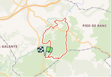
Trail Walking of 13.9 km to be discovered at Provence-Alpes-Côte d'Azur, Var, Vidauban. This trail is proposed by soca.

Description

Vidauban- D48- Départ le hameau des fenouils - Tour des bois de Bouis - Réserve naturelle de la plaine des Maures par la Bernardine, le Tien de Roure, Gascarin, le Gourd du baron, la cascase de l'Aille, le prés de Réclou, les prés d'Aille - retour vers les fenouls.

Elevation profile

Positioning

Country:
France
Region :
Provence-Alpes-Côte d'Azur
Department/Province :
Var
Municipality :
Vidauban
Location:
Unknown
Start:(UTM)
293311 ; 4805397 (32T) N.

Comments

Please log in to post a review or rate the element


Début de la rando dans une Foret incendiée .....snifffffff Apres la cascade de l Aille difficile de trouver la piste ....


Close
My subscriptions