


Saint Pierre - Pont de Bellecombe

Kargil
User GUIDE

Length
24 km

Max alt
490 m

Uphill gradient
206 m
Km-Effort
27 km

Min alt
427 m

Downhill gradient
206 m
Boucle
Yes
Creation date :
2022-03-07 13:19:41.753
Updated on :
2022-03-08 07:21:10.523
4h50
Difficulty : Easy

FREE GPS app for hiking
 SityTrail
IGN / Geographical institutes
SityTrail Plus
The world is yours!
About
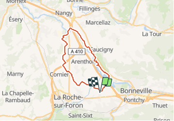
Trail Walking of 24 km to be discovered at Auvergne-Rhône-Alpes, Upper Savoy, Saint-Pierre-en-Faucigny. This trail is proposed by Kargil.
Positioning
Country:
France
Region :
Auvergne-Rhône-Alpes
Department/Province :
Upper Savoy
Municipality :
Saint-Pierre-en-Faucigny
Location:
Unknown
Start:(Dec)
Start:(UTM)
295655 ; 5105842 (32T) N.
Comments