


Rs OROIX 2022

LouisROGER
User GUIDE
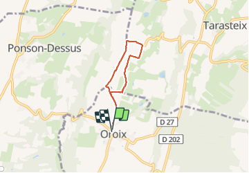

Length
4.7 km

Max alt
370 m

Uphill gradient
25 m
Km-Effort
5.1 km

Min alt
356 m

Downhill gradient
26 m
Boucle
Yes
Creation date :
2022-03-08 13:06:39.112
Updated on :
2022-03-08 15:06:49.544
1h34
Difficulty : Easy

FREE GPS app for hiking
 SityTrail
IGN / Geographical institutes
SityTrail Plus
The world is yours!
About
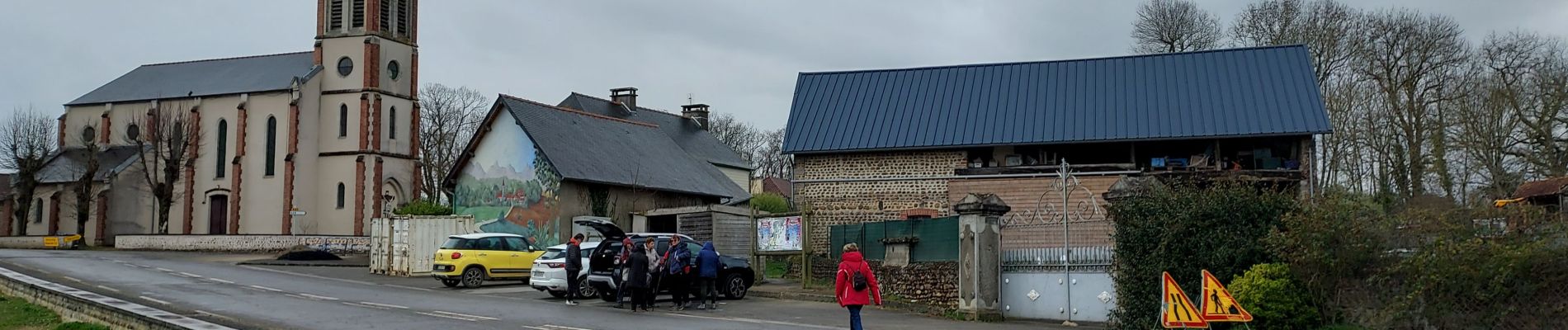
Trail Walking of 4.7 km to be discovered at Occitania, Hautespyrenees, Oroix. This trail is proposed by LouisROGER.
Photos

Positioning
Country:
France
Region :
Occitania
Department/Province :
Hautespyrenees
Municipality :
Oroix
Location:
Unknown
Start:(Dec)
Start:(UTM)
740668 ; 4798607 (30T) N.
Comments