


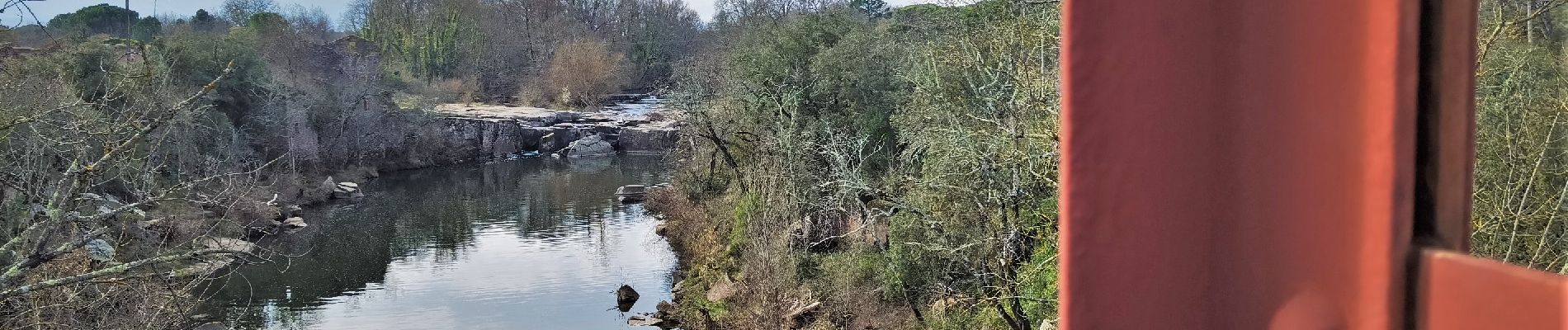
Vidauban cascade et pont de fer de l'Aille

bernir
User
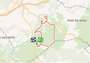

Length
14.4 km

Max alt
109 m

Uphill gradient
156 m
Km-Effort
16.4 km

Min alt
42 m

Downhill gradient
156 m
Boucle
Yes
Creation date :
2022-03-10 08:37:12.789
Updated on :
2022-03-10 18:28:16.007
6h19
Difficulty : Easy

FREE GPS app for hiking
 SityTrail
IGN / Geographical institutes
SityTrail Plus
The world is yours!
About
Trail Walking of 14.4 km to be discovered at Provence-Alpes-Côte d'Azur, Var, Vidauban. This trail is proposed by bernir.
Photos

Positioning
Country:
France
Region :
Provence-Alpes-Côte d'Azur
Department/Province :
Var
Municipality :
Vidauban
Location:
Unknown
Start:(Dec)
Start:(UTM)
293310 ; 4805406 (32T) N.
Comments