


les maures

soca
User
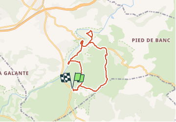

Length
14.8 km

Max alt
109 m

Uphill gradient
156 m
Km-Effort
16.8 km

Min alt
42 m

Downhill gradient
155 m
Boucle
Yes
Creation date :
2022-03-10 08:44:12.519
Updated on :
2022-03-10 15:09:04.105
5h00
Difficulty : Very easy

FREE GPS app for hiking
 SityTrail
IGN / Geographical institutes
SityTrail Plus
The world is yours!
About
Trail Walking of 14.8 km to be discovered at Provence-Alpes-Côte d'Azur, Var, Vidauban. This trail is proposed by soca.
Positioning
Country:
France
Region :
Provence-Alpes-Côte d'Azur
Department/Province :
Var
Municipality :
Vidauban
Location:
Unknown
Start:(Dec)
Start:(UTM)
293302 ; 4805408 (32T) N.
Comments