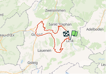
Trail Mountain bike Lenk - Trüttllisbergpass - Photo

Optez pour le retour à la nature GUIDE+

© OpenStreetMap contributors
Length
Length
58 km
Max alt
Max alt
2075 m
Uphill gradient
Uphill gradient
2112 m
Km-Effort
Km-Effort  
87 km
Min alt
Min alt
995 m
Downhill gradient
Downhill gradient
2113 m
Boucle
Boucle
Yes
Creation date :
2014-12-10 00:00:00.0
Updated on :
2014-12-10 00:00:00.0

(0 Reviews)

Mountain bike
Mountain bike
18h07
Difficulty : Unknown

Scan this QR Code to open this trail in the SityTrail application

FREE GPS app for hiking

Logo SityTrail SityTrail

IGN / Geographical institutes

Download SityTrail from the App Store Download SityTrail from Google Play

Logo SityTrail SityTrail Plus

The world is yours!

Download SityTrail from the App Store Download SityTrail from Google Play Download SityTrail on Huawei AppGallery

About

Trail Mountain bike of 58 km to be discovered at Bern, Obersimmental-Saanen administrative district, Lenk. This trail is proposed by My Switzerland.

Elevation profile

Points of interest

Point of interest Lenk - Betelberg - Photo
My Switzerland
LENK 
Point of interest Saanen - Bahnhof Gstaad - Photo
My Switzerland
Point of interest Saanen - Schönried - Photo
My Switzerland
SAANEN 
Point of interest Saanen - Saanenmöser - Photo
My Switzerland
SAANEN 
Point of interest Saanen - Hornberg - Photo
My Switzerland
SAANEN 
Point of interest Lenk - Bahnhof Lenk - Photo
My Switzerland
Point of interest Lenk - Bahnhof Lenk - Photo
My Switzerland

Positioning

Country:
Switzerland
Region :
Bern
Department/Province :
Obersimmental-Saanen administrative district
Municipality :
Lenk
Location:
Unknown
Start:(UTM)
380533 ; 5146038 (32T) N.


Close
My subscriptions