


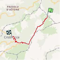

9.8 km | 17.6 km-effort

User


FREE GPS app for hiking
 SityTrail
IGN / Geographical institutes
SityTrail World
The world is yours!
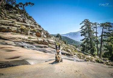
Trail Walking of 8.8 km to be discovered at Corsica, South Corsica, Cristinacce. This trail is proposed by tracegps.
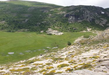
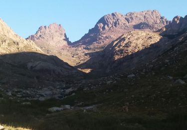
GR 20® Liaison de Bocca San Petru à Cristinacce Liaison 04 Le village de Cristinacce est construit sur un mamelon rocheux à 830 m d'altitude, au pied du col de Sevi (1100m), à 70 km au Nord d'Ajaccio et à 35 km de Sagone. Il est dominé, au Nord par le Capu di Melo (1562m) et à l'Est par la chaine du Tritore culminant à plus de 2000m. On dénombre une petite cinquantaine de maisons dont une majorité n'est maintenant habitée que l'été. Le village est entouré de châtaigneraies qui ont assuré jusqu'à présent, avec les porcs, les bovins et les jardins, l'essentiel de l'économie de cette région. Tourisme, charcuterie artisanale, vente de miel de confitures et de farine de châtaigne sont les composantes de l'activité de cette région qui a su concilier respect du patrimoine et activités touristique. Les sources alimentant en eau le village sont très pures et abondantes. L'une d'entre elle qui alimente la fontaine publique est reconnue posséder des vertus thermales semblables à l'eau de Volvic. (source Wikipedia) Vous trouverez le descriptif détaillé de cette randonnée dans le Topo-guide® de la Fédération Française de la Randonnée Pédestre. Pour toute information complémentaire sur la randonnée : Comité départemental de la Corse: 6 RUE DU CAPITAINE BENEDETTI 20100 SARTENE Tél. : 0495771821

Walking

Walking
Walking
Walking
Walking
Walking
Walking
Walking
Walking